History and Important Sites
The Turnpike Trails project has multiple goals: recreation, conservation, and historical preservation. There are multiple historical signs to be found around the trail network, which share some highlights and history of specific key sites, but there is much more history behind these signs. This page serves to capture that history. Where there are important deeds or property transfers, the associated book and page number references are included from the Hillsborough County Registry of Deeds. If you are more interested in a brief background of how this trail project came together, rather than the historical record, please see the About page.
The Early Years
The full historical narrative starts with an English merchant and sailor named Captain John Mason, who was very involved in the early mapping and settlement of Newfoundland and served as its governor from 1615 to 1621. Under the authority of King James I of England, in 1622, Captain Mason and Sir Ferdinando Gorges obtained a land patent (deed) for property in colonial America. When they divided up this property in 1629, Captain Mason ended up with the portion that became known as the Province of New Hampshire, encompassing a large portion of what is now the State of New Hampshire and totaling nearly 2 million acres.
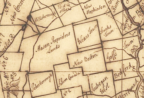
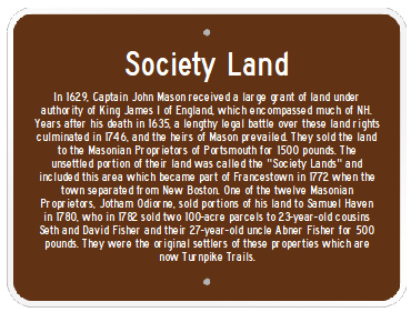 After John Mason's death in 1635, his heirs inherited these properties but did nothing with them. Over the years, the Massachusetts Bay Colony began sponsoring settlements on the land, leading to a long and drawn-out legal battle over land ownership. This dispute was eventually settled by an English court in 1746 which ruled in favor of Mason's heirs. This land was then sold to a group of 15 enterprising merchants from Portsmouth, NH, known as the Masonian Proprietors, for 1500 pounds. Their lands became known as the Society Lands. These merchants quickly settled disputes with existing towns within their properties and took on the task of sponsoring new settlements. They were innovative in their approach to many of these town charters: they retained a portion of land within each settlement for their own benefit if the town was successful over time.
One of these merchants was Jotham Ordiorne who took possession of lands around Crotched Mountain, known as Parcel 9, that included the part of Francestown where Turnpike Trails is now located. Francestown was founded on June 25, 1772 and in defining the lands within this new town, a portion of his Society Land was combined with a portion of New Boston (called the New Boston Extension) to create the Town of Francestown. In 1780, the heirs of Jotham Ordiorne eventually sold land from Parcel 9 in Francestown to Reverend Samuel Haven of Portsmouth (Book 8, Page 370).
The Pioneers
In 1782, 23-year-old cousins Seth and David Fisher and their 27 year-old uncle Abner Fisher bought two 100-acre lots, numbers 17 and 18, from Samuel Haven for 500 pounds (Book 11, Page 377). These properties are located on the slopes of what was known as Oak Hill, now called Campbell Hill. All men were former Massachusetts Revolutionary War soldiers, and David and Abner were newly married the prior year. David and Seth were born 10 days apart, and their uncle Abner was only 4 years older.
David Fisher was born in Sharon Mass on June 26, 1759. He entered the Revolutionary Army when he was just 16 and served as a private. On November 20, 1781 he married Mehitable Hewins, born on February 20, 1762. David, known as “King David,” was large and athletic, his “common weight” when in the prime of life was 250 pounds. Upon coming to Francestown he "cleared the farm known as the James Whitfield place, on the northeastern slope of Oak Hill. Here he reared a family of 3 children." This farm location is on the western side of what is now Fisher Hill Road. He built his saw mill around 1800, located about 2 miles north of Francestown towards Deering. It was located on Fisher Brook (now called Collins Brook). Remnants of this mill can still be seen along what is now Old Country Road North. He died November 8, 1829, and his wife died 20 years later.
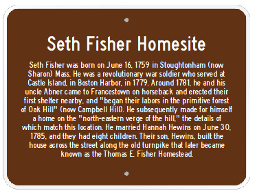 Seth Fisher was born on June 16, 1759 in Stoughtonham (now Sharon) Mass. He was a Revolutionary soldier in Ralph Thompson’s company, Col. Webb’s regiment, and also served in a Suffolk County regiment under the command of General Hancock for service at Castle Island in Boston Harbor. Around 1781, he and his uncle Abner came to Francestown on horseback, erected their first shelter “and began their labors in the primitive forest of Oak Hill." Their first shelter was very likely on the property of Upper Turnpike Trails. Seth Fisher married Hannah Hewins June 30, 1785 - she was the sister of Mehitable Hewins - and together they settled land on the north-eastern edge of the hill, south and east of David Fisher's land. Research has identified the likely site of his early homestead as being located on Lower Turnpike Trails, along the trail known as Chasing Cars.
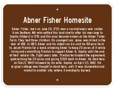 Abner Fisher was born on June 20, 1755 in Dedham, Mass, and married Sophia Hibbard of Dedham on June 20, 1781. He was a private in Capt. William Bullard's company, serving for twelve days at the Lexington alarm, and served on Dorchester Heights for seventeen days. After his marriage, in 1782, he and his wife settled on the slopes of Oak Hill to the west of Seth and south of David. This property became known as the Abner Fisher Farm. Research indicates the cellar hole along the Bumpy Ride trail as being the location of Abner's original home. Upper Turnpike Trails includes portions of the Abner Fisher Farm and a small portion of Seth's farm, while Lower Turnpike Trails consists of much of Seth's property and some of David's land as well.
The road now known as Fisher Hill Road was "accepted" by the town of Francestown in 1783 and passed along the original boundary between Abner's land and Seth's land, and passed through David Fisher's land as well. Acceptance is a legal process whereby a town accepts the layout of a road as a public highway and agrees to maintain it moving forward. The minutes from town records in 1783 describe this road in part as passing "down Hillsboro old road then south thru David Fisher's to road between Abner Fisher's and Seth Fisher's." This road crossed so-called Fisher Brook at the exact location where a current trail now passes over a wooden bridge (Fisher Bridge) off Old County Road North - the original "Hillsboro old road." There is a small waterfall under the bridge. This road was a part of what was at the time called the "County Road" which connected Francestown to Deering (and on to Hillsboro), and which also included Oak Hill Road in Francestown (now partly a Class VI road) and the portion of today's Old County Road North from this wooden bridge to the Deering line.
The Turnpike and Second Fisher Generation
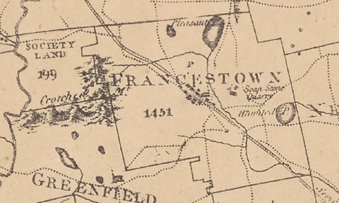
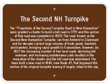
The New Hampshire Legislature granted the “Proprietors of the Second Turnpike Road in New Hampshire” a charter to build a toll road in 1799. This road, which was laid out largely in a straight line from the "plains of Amherst" to Claremont, New Hampshire passed directly through the center of Francestown. In 1800, a section of this road was constructed through Seth Fisher and Abner Fisher's properties, through what is now Upper Turnpike Trails. This new road, known as the Second New Hampshire Turnpike, brought growth and prosperity to Francestown and for several decades carried large volumes of trade goods, livestock, and travelers through town. The map on the right, part of a map of New Hampshire published in 1816, clearly shows the large turnpike road (indicated with double lines) passing through the center of town. Fisher Hill Road is also shown, represented by the dotted line that appears just above the "C" in FRANCESTOWN. Oak Hill Road parallels the turnpike to the left. In the upper left of this map, you can see some land still labelled "Society Land" that would eventually become part of the town of Bennington. Click on the image for a larger view.
The Second NH Turnpike triggered a period of growth for Francestown and likely benefited not only Seth and Abner, but their children as well. Seth and Hannah Fisher had eight children, four of which died at an early age. One of his sons, Hewins Fisher, who was born in 1793, eventually made his living as a carpenter and farmer. Sometime in the early 1800s, Hewins built a home on his father Seth’s land, picking a location directly along the turnpike, next to Signature Rock and where the Upper Turnpike Trails parking area is now. These foundations remain very visible today. Hewins settled there with his wife Betsey Butterfield and they had a single child, Thomas, who was born in 1819. Seth Fisher died in 1811 and his wife, Hannah, in 1847. They are both buried in Francestown Cemetery #2.
In the meantime, farther down the turnpike, Abner Fisher and his wife Sophia (also known as Zerviah, her maiden name was Hibbard) had three children. The youngest, Jesse, was killed in the war of 1812. Their oldest son, Ira, built a home on property of the Abner Fisher Farm, also along the Second NH Turnpike, on a small knoll in the very center of Upper Turnpike Trails. Ira lived here for a time and this house would later become known as the Nutting House.
Following the death of Seth Fisher in 1811, Seth Jr., the eldest son of Seth Fisher, paid some of the other heirs $200 in 1816 in exchange for a large portion of Seth's 78-acre farm while the other heirs retained 26 acres at the south end of the farm, where Hewins had his house (Book 110, Page 610). Later, in 1819, Hewins paid $600 to buy out the remaining heirs and obtain sole ownership of those 26 acres that contained his homestead (Book 122, Page 522).
In 1823, Hewins Fisher purchased an adjacent portion of the Abner Fisher Farm from Abner and Ira Fisher for $100 (Book 141, Page 19). This parcel of land was located west of Fisher Hill Road, and along the turnpike, adjacent to and between Hewin's home and Ira's home. That same year Abner and Ira Fisher sold the other 80 acres of their farm to Jacob Preston, a local blacksmith, for $1000 (Book 139, Page 254). As a part of the deal to purchase this property from Abner, Preston allowed Abner to continue to live on 40 acres and agreed to a bond to support Anber and his wife for the rest of their natural lives. If he failed to meet this commitment, he had to give the 40 acres of land back to Abner (Book 139, Page 253). Preston sold the other 40 acres of this land to Samuel Burge (Book 139, Page 252).
Burge subsequently passed away and Burge's 40 acres was divided into two 20-acre parcels. The Burge estate administrator sold the northernmost 20-acre parcel to Alexander Wilson, and the other 20 acres was either sold or given back to Preston (see language in deed Book 167, Page 98-99). By 1831, Preston was apparently getting tired of supporting Abner Fisher so in exchange for $500 paid by Abner to Preston, Abner got his 40 acres back and Preston was free from his bond (Book 167, Page 98).
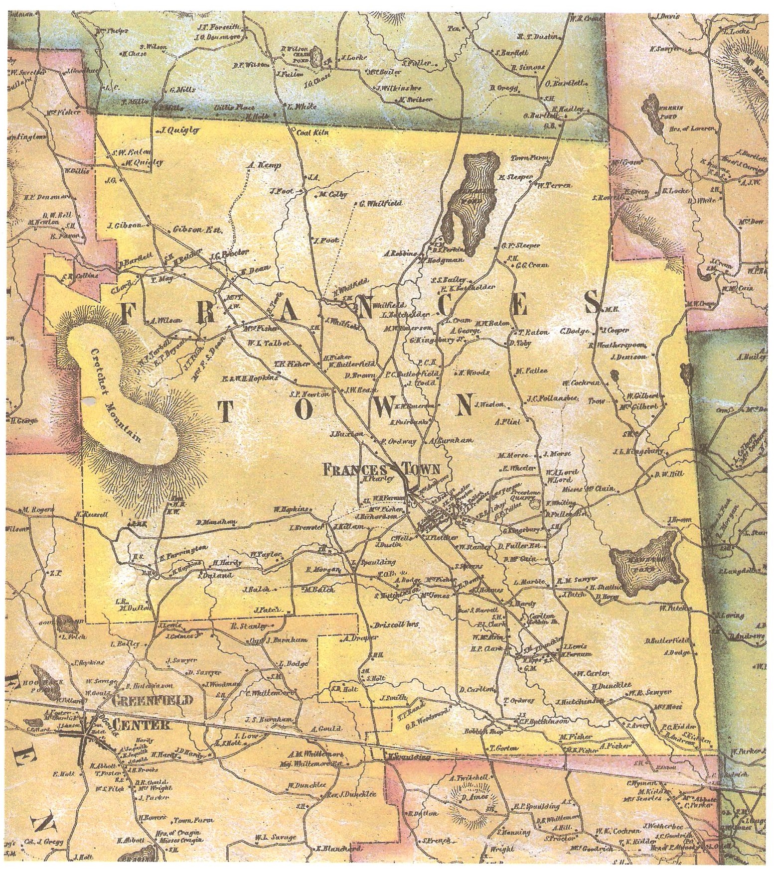
Next, Ebenezer Talbot comes in to the picture. That same year, in 1831, Ebenezer purchased both the 20 acres from Preston for $200 (Book 167, Page 98) and the 40 acres from Abner Fisher for $1000 (Book 192, Page 455), re-uniting 60 acres of the original Abner Fisher Farm. Ebenezer Talbot moved into the original Abner Fisher house, while his son William moved into the other house on the property, originally built by Ira Fisher and later known as the Nutting House. Where Abner and his wife lived after they sold their land and home is not clear, but Abner passed away in Francestown in 1840 and his wife in 1842. Abner is buried in Francestown Cemetery #2. A map of Francestown, published in 1858 - 27 years after Abner sold his property - clearly identifies Talbot as the resident of this home at the time the map was published (see W. L. Talbot appearing just under the A in Francestown). Click on the map to expand the picture and see the full map. You can also see on this map the location of David Fisher's orginal farm, shown on the map by its later name the J. Whitfield place, slightly up and to the right of the Talbot homestead along Fisher Hill Road. Between the two locations, along what would soon be the so-called "new turnpike" - now Route 47 - you also see the letters S. H. This was the original location of Francestown School House #2.
Demise of The Turnpike
By 1837, the Proprietors of the Second Turnpike Road in New Hampshire, the corporation which operated the Second NH Turnpike toll road, was in a lot of trouble. Free local roads continued to be built by towns, resulting in loss of toll revenue. The maintenance costs of the turnpike were also increasing as the road aged and was impacted by traffic. New Hampshire chartered its first railroad in 1831, an emerging form of transportation. As a result of these developments, the turnpike corporation petitioned the NH Legislature to revoke their charter to operate the turnpike road, and in June of 1837, their request was granted. The result was that the Second NH Turnpike was abandoned.
 Sections of the turnpike following public town roads that existed before the turnpike was laid out were still town roads and thus continued to be maintained by the towns. However sections of road that were built by the turnpike corporation specifically as part of the toll road were not public roads and towns were not obligated to start maintaining them, causing problems for some travelers (see State v. New-Boston, 11 N.H. 407). This is because only the turnpike corporation was granted the right-of-way for the purpose of constructing the toll road, not the general public. Once the turnpike corporation ceased to exist, those rights were extinguished. Some towns laid out new roads along the path of the old turnpike, officially turning them into town roads. Some sections of road continued to be used by the public for a long enough period of time that the towns eventually picked up maintenance of the road as a practical manner (a process called prescription).
In the case of the section of the turnpike that crossed the Fisher properties, now Upper Turnpike Trails, the town made a decision to build a new road, now Route 47, and bypass this portion of the turnpike. This new road was laid out by the town selectmen in September of 1837, with a goal to "save hill and distance" as noted in the 1895 History of Francestown, NH by Rev. W. R. Cochrane. "Hill and distance" references how the original turnpike went up a section of Oak Hill as it passed through Upper Turnpike Trails, later coming back down the hill along a section of road now known as Old Turnpike Road beyond Turnpike Trails. Residents characterize the section of the turnpike being bypassed as also being very wet and muddy, conditions which persist today each spring. The creation of the new road was the subject of much debate within town, with many residents opposed to its creation. It took several town meetings to sort this situation out but the new road was finally completed in 1840, and this road has at times been referred to as the "Fisher Bend" or "New Turnpike." Hewins Fisher received payment of $134 in compensation for the impact of the new road crossing his property (just north and downhill from his homestead), and Ebenezer Talbot was compensated $160 dollars as the road also crossed his property for a long distance. The properties of Thomas Eaton and Issac Towle were impacted by the new road, at the western end, and were compensated $44 and $50 dollars respectively.
With the town building a new, better, and flatter road that bypassed this section of the original turnpike, it is fairly clear that the portion of the original turnpike that crosses Upper Turnpike Trails never became a public (town) road after it was abandoned by the turnpike corporation in 1837. There are no records of the town ever laying out another road through this path. However, to remove any lingering doubt, at town meeting in 1994 there was an affirmative vote to discontinue this specific section of road crossing the parcel now known as Upper Turpike Trails (at the time, owned by Huberman and Wallack). Discontinuance is the legal process whereby a town terminates the public's right to use a road. For reference, see Francestown Town Reports from 1994 and 1995.
The path of this new road crossed the existing town road known as Fisher Hill Road, historically also referred to as a portion of the County Road. By intersecting this road, Fisher Hill Road was divided into a short southern segment, which connected Hewin Fisher's house to the newly constructed road, and a much longer northern segment, which connected the new road to what is now Old County Road North at Fisher (Collins) Brook. In light of the new road being created, the upper (southern) and shorter section of Fisher Hill Road was no longer needed and thus in 1840 the town voted at town meeting to discontinue the section of Fisher Hill Road between Hewins Fisher's house and "the road now making," which was the new turnpike or now Route 47. This section of road, discontinued in 1840, is located entirely within Upper Turnpike Trails. With the discontinuance vote, that road ceased to be a public highway. As a result of these road developments between 1837 and 1840, there are no public roads on either Upper Turnpike Trails or Lower Turnpike Trails. The current parking area on Upper Turnpike Trails is on private property. The lower (northern) section of Fisher Hill Road remains a public highway to this day and continued to connect Francestown and Deering until the portion of this road closest to Collins Brook fell into disrepair by the early 1900s. It eventually became Class VI after a vote of the town in 1935 (discontinued subject to gates and bars).
Dr. Thomas E. Fisher
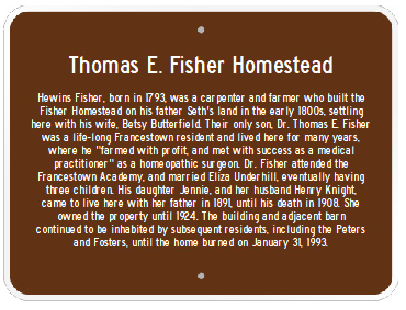 When the 1858 map of Francestown was published, the home originally built by Hewins Fisher along the turnpike is marked as being inhabited by both H. Fisher and T. E. Fisher, referring to Hewins Fisher and his son, Thomas E. Fisher. Dr. Thomas E. Fisher was the only son of Hewins and Betsey Fisher and a life-long Francestown resident, where he “farmed with profit, and met with success as a medical practitioner” as a homeopathic surgeon. Dr. Fisher attended the Francestown Academy, and later served as a select board member, member of the state legislature, and school superintendent. He married Emeline G. Emerson, who died in 1845, and later Eliza A. Underhill, with whom he had three children: Ellen, Jane (Jennie), and Orlando. The house originally built by his father became known as the Thomas E. Fisher Homestead. Thomas' mother Betsey Fisher died in 1839, while Hewins Fisher lived until in 1872. As their only child, Thomas Fisher ended up with a sizeable estate following his parents death.
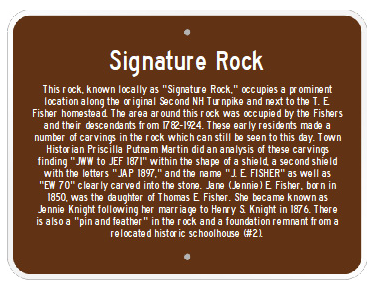
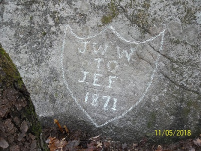 His daughter Ellen married and moved away, while his son Orlando remained in Francestown but died at the age of 30, in 1886. It is his daughter Jennie who has the most interesting story related to the property of Turnpike Trails. Jennie was born in 1850 and married Henry S. Knight from Westminster, MA, in 1876, thereafter being known as Jennie Knight. Jennie grew up at the Fisher Homestead, and during her early adult years, the earliest carvings started to appear on Signature Rock, a large granite boulder which occupies a prominent location along the original Second NH Turnpike and next to the T. E. Fisher Homestead, now the parking area at Upper Turnpike Trails. The area around this rock was occupied by the Fishers and their descendants from 1782-1924. Many of the carvings in the rock can still be seen to this day. Francestown Historian Priscilla Putnam Martin did an analysis of these carvings finding “JWW to JEF 1871” within the shape of a shield, a second shield with the letters “JAP 1897,” and the name “J. E. FISHER” as well as “EW 70” clearly carved into the stone. Photo courtesy of Priscilla Putnam Martin.There are other carvings as well, and also a “pin and feather” (like a small piton) in the rock. The adjacent foundation remnant was the site of the historic schoolhouse #2 that was moved here at one point from its prior location along the new turnpike.
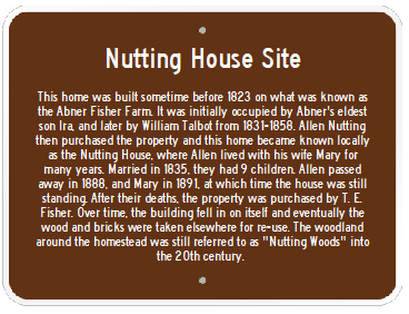 Another individual who would leave his mark on Turnpike Trails history was Allen Nutting. Allen was born in Francestown on September 6, 1809 and married Mary Hopkins of Francestown on April 28, 1835. After living for 20 years in Vermont, Allen moved back to Francestown where in 1858 he purchased the remaining 60 acres of the Abner Fisher Farm from William Talbot, the son of Ebenezer Talbot, for $1300 (Book 316, Page 162). He had 7 children with his wife Mary. They lived in the Talbot house, originally built by Ira Fisher, and this home eventually became known locally as the Nutting House. The foundation of this structure is still clearly visible and located in approximately the center of Upper Turnpike Trails, very close to the old turnpike and near the 4-way intersection at the end of the trail named Runnin' Down a Dream. There was a woodland area near the house, possibly used as a woodlot, which was referred to as Nutting Woods, and this name was still used well into the 20th century. Allen died in 1888 and his wife Mary in 1891. They are both buried in Francestown Cemetery #3. Their son Charles was the proprietor of the Francestown Hotel, and was a selectman at the time of his own death in 1890, just two years after his father. The Nuttings were the last known residents of the Nutting House.
When a new Francestown map was published in 1892, included in Rev. Cochrane's 1895 History of Francestown, T. E. Fisher is shown as living in the Fisher Homestead (see map at left, click for full map view). However, the Nutting House is no longer shown on the map, and the old turnpike road that passes through Upper Turnpike Trails is gone, no longer shown as a road. The Abner Fisher home is also long gone. It is known from town history books that the Nutting House continued to stand for years, eventually collapsing and falling in on itself. Residents remember some semblance of a collapsed building at this location into the 1950s when at some point the remaining useful construction materials, including the original bricks, were taken elsewhere and re-used. You can still find some scattered, shattered bricks around the foundation site.
With the demise of the turnpike in 1837 and the railroads passing through other towns, Francestown experienced a long period of decline through the later 1800s and early 1900s. The town population, which was near 1600 around 1840, fell to mere hundreds by the early 20th century. It is only in the last couple decades that the population of Francestown once again exceeded 1600 residents. Within this backdrop, Jennie (Fisher) Knight and her husband Henry came to live at the Fisher Homestead in 1891 with her father.
Thomas Fisher proceeded in the coming years to purchase and consolidate much of the surrounding land that is now Turnpike Trails, adding it to the land he inherited from his parents. At some point, he purchased sections of land formerly part of the David Fisher property, along Fisher Brook (Collins Brook). In 1893, he purchased a 30-acre portion of the Nutting property, including the Nutting House site, from the descendants of Allen Nutting (Book 533, Page 498). In 1897, he sold a large portion of his land to his daughter Jennie Fisher for $1000, which included most of Turnpike Trails and including what is now the Fisher Hill Town Forest and the conservation property owned by the Francestown Land Trust (FLT) along Fisher Hill Road (Book 566, Page 178). In 1902, he purchased a large tract of land along and around Campbell Hill Road from Hanna Frances Jones, a Campbell descendant (Book 610, page 84), who had previously acquired it from Isaac T. Campbell in 1887 (Book 488, Page 429). Eventually all the property ended up in the hands of Jennie Fisher when Thomas E. Fisher died in 1908. He is buried in Francestown Cemetery #3.
Beyond The Fishers
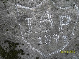 In 1914, Jennie (Fisher) Knight sold a small lot of land to John Arthur Peters. This deed, although executed in 1914, was not filed with the registry of deeds until June 2, 1953 (Book 1356, Page 314). This lot was a small piece of the original Seth Fisher land north of what is now Route 47, and this piece was a "carve-out" of the parcel now known as the Fisher Hill Town Forest. It is located directly across the street from the original turnpike where it breaks left off Route 47 leading to the Upper Turnpike Trails parking area and Signature Rock. John A. Peters is one of the individuals whose initials appear on Signature Rock: "JAP 1897" (photo again courtesy of Priscilla Putnam Martin). It is also belived that the initials "EW 70" carved into Signature Rock are in memory of Emma Woodward, a relative of John Peters, who was born in 1870 but died in 1899. Although not part of Turnpike Trails, in 1952 this lot was purchased by Harry James Putnam and his wife Ellen Joyce (Chapman) Putnam, after whom the Putnam Loop trail is named (Book 1356, Page 329). They built a new house on the site of an older home that had burned many years earlier (rumored to be caused by "smoking materials"). They were the parents of Priscilla Putnam Martin, Francetown historian who contributed to this research. In recent years, another more modern house was built on the same site.
In 1916, Jennie Knight sold the large tract of land around Campbell Hill, that her father had purchased from Hanna Jones, to George E. Whitcomb and George Whitcomb, Jr (Book 746, Page 302). One border of this parcel was adjacent to the old turnpike, directly across from the Fisher Homestead where she was living. The land she was selling was holding a crop of potatoes, and additionally her house was being fed by pipes from a spring located on this parcel she was selling. For this reason, the deed to the Whitcomb's included the following text:
"Reserving the present crop of potatoes, with the right to cultivate and harvest the same. Reserving also to Jennie E. Knight, her heirs and assigns forever, the spring of water on said premises and pipes connected with the same and used in conveying water from said spring to said buildings. Reserving also the right to occupy the pasture land until November 1, A.D., 1916."
The next year, this same large tract was sold by the Whitcombs to Levi M. Bixby (Book 757, Page 415). Those covenants carried with the property in the new deed, namely that Jennie Knight and her heirs and assigns retained the right to draw water from the spring on the property.
Henry Knight, Jennie's husband, died in 1923. In 1924, Merrill J. Dodge bought the Fisher Homestead from Jennie Knight for one dollar and other valuable consideration (Book 834, Page 202). This transfer included the house and other surrounding properties that she bought from her father for $1000 in 1897, so this covered basically all of the current trail network, but it did not include the Bixby property which contained the spring and which had been sold previously. Merrill Dodge received rights to the spring in his new deed. Jennie moved in with her niece, Ethel J. Glynn, until her death in 1931. She, along with her husband Henry Knight, are buried side by side in Francestown Cemetery #3.
The Peters and Fosters Era
Merrill Dodge did not stay too long. Four years later, on Sept. 26, 1928, he proceeded to sell these same lands to Frederick A. Peters of Milton, MA, again for one dollar and other valuable consideration (Book 884, Page 112 and Book 881, 128). Fred was the brother of John A. Peters mentioned above. Merrill Dodge had deeded rights to the spring on the Bixby property, and these rights were now transferred to Fred Peters with this subsequent sale and appeared in that deed as well. However, it seems Fred Peters may have had an issue with being reliant on water for his house coming from a spring on someone else's property. History shows that one day later, Merrill Dodge purchased a small piece of land from Levi Bixby (Book 881, Page 284) - a small parcel containing the spring and only about 3-4 acres in size. The location is described as southwest of the old turnpike - and being a part of the larger parcel Bixby purchased from George Whitcomb in 1917. Then, two days later on Sept. 29, 1928, Merrill Dodge sold this additional small parcel containing the spring to Fred Peters (Book 884, Page 110). Fred now controlled his water supply as well.
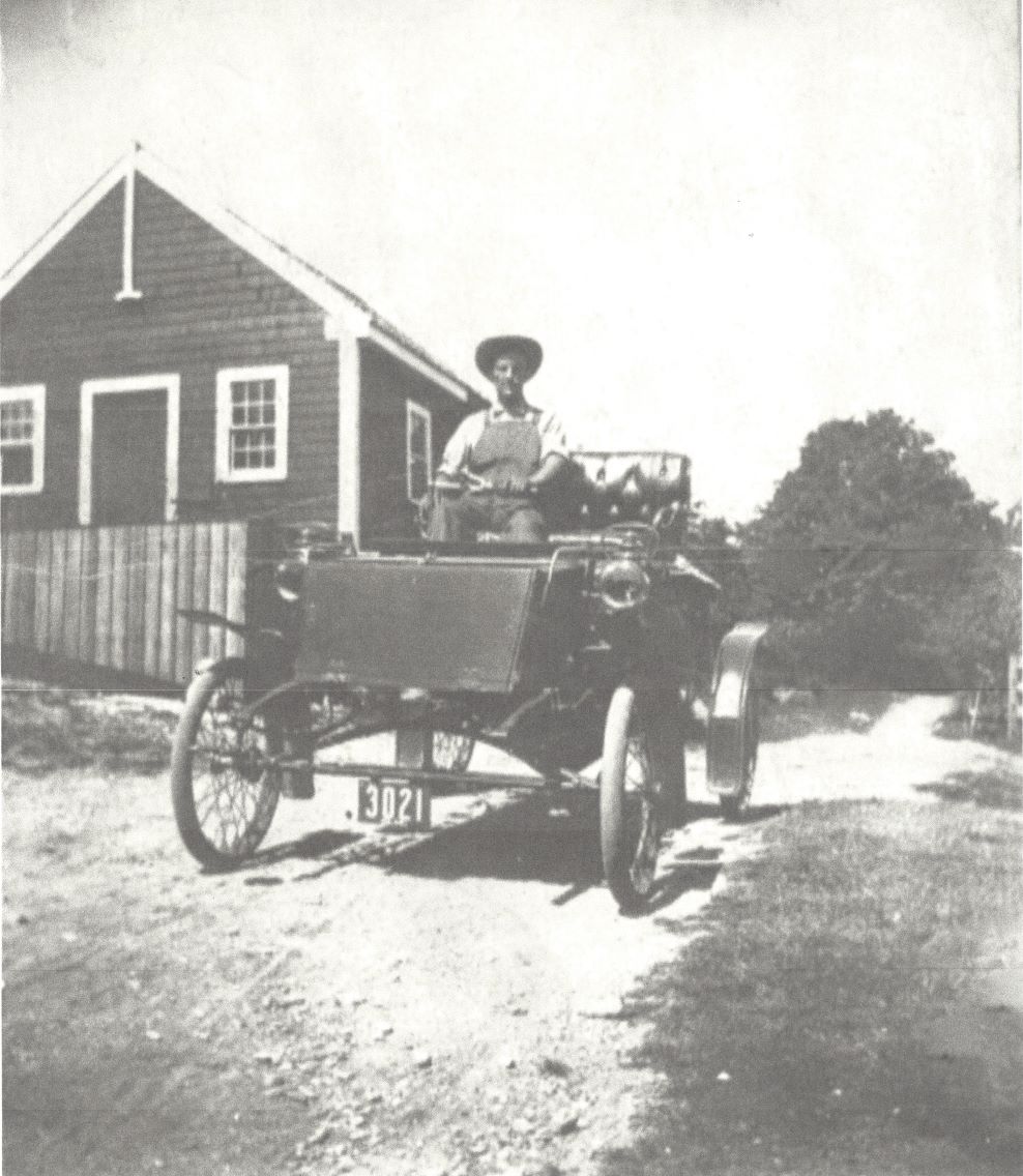 In 1928, Fred Peters now owned all the land that would eventually contain the Turnpike Trails network, including Upper Turnpike Trails, Lower Turnpike Trails, the Fisher Hill Town Forest, and the FLT conservation property along Fisher Hill Road. Here is a photo of Fred Peters driving an early electric car, taken very close to Signature Rock. The small building in the background, blocking Signature Rock in the photo, was the original Francestown School House #2, which was relocated from its original location to this site at some point (it was later relocated again to another property near the center of Francestown where it currently stands). Photo credit goes to John Frederick Peters and Alice (Peters) Lazenby, and was provided for use here courtesy of Priscilla Putnam Martin. At some point during their ownership of this property it is believed that Japanese Knotweed was introduced to the property. According to Priscilla Putnam Martin, "The story goes that it was introduced to the property to entice the bees. I expect that meant that the Peters family introduced it. My Pop told us that story (Harry James Putnam 1907-2006). The Peters family are our cousins. So Pop would have heard it from the horse's mouth." The Peters family held these parcels until 1949, when they sold them to Joseph C. Foster and Agnes L. Foster (Book 1236, Page 371).
In describing the properties in the deed from Fred Peters to the Fosters, three separate and distinct parcels are identified:
FIRST PARCEL: The small lot of land containing the spring that fed the Fisher Homestead, southwest of the old turnpike and across from his home (this was originally a portion of the Bixby land).
SECOND PARCEL: All the land north of Route 47, encompassing approximately 140 acres consisting of the Fisher Hill Town Forest, Lower Turnpike Trals, and the FLT conservation property.
THIRD PARCEL: The land that is now Upper Turnpike Trails, containing approximately 33 acres and containing within it the old turnpike, the Nutting House site, the Abner Fisher home site, and the Fisher Homestead, which was still standing and being used as a residence.
In the language of this deed from Peters to Foster was once again the rights to the spring. The third parcel in this case carried the rights to the spring located on the first parcel.
Interestingly, a few years before the Fosters completed the purchase of these lands, in 1945, Levi M. Bixby proceeded to transfer his abutting lands to his heirs, Peter A. Bixby, Thomas E. Bixby III, and Thomas E. Bixby IV (Book 1075, Page 294). This property was the large parcel on Campbell Hill Road that had previously been owned by Jennie Knight and the Whitcombs. This property once contained the spring mentioned above, until that small parcel was carved out and sold to Merrill Dodge in 1928 (this is the parcel now described as the "first parcel" above). In describing the property being transferred from Levi Bixby to his heirs, the 1945 deed includes the following language:
Reserving also to Fred A. Peters, his heirs and assigns forever, a small tract of land containing a spring of water near his premises, being the same conveyed to Merrill J. Dodge by me (again see Book 1075, Page 294).
With this language, Levi Bixby is indicating that the small parcel with the spring is not part of the land transfer to his heirs, which makes sense, as he had already sold it to someone else.
Joseph C. Foster and his wife Agnes lived in the Fisher Homestead for a period of time, and at some point a mobile home was added near the house. This mobile home was later moved across the street to where the storage container is currently located at Lower Turnpike Trails. Joseph Foster died on Jan. 9, 1965 and Agnes died a short time thereafter. The lands described as the "first," "second," and "third" parcels then became owned by their heirs, Violet Foster McCarthy (daughter), Charles L. Foster, Sr. (son), and Albert L. Foster (son). The Foster children made the decision to sell the "first" and "third" parcels, and subdivide the "second" parcel three ways with each child receiving one of the three new parcels. The "first" and "third" parcels were to the south of Route 47, and represent what is now Upper Turnpike Trails. The "second" parcel was north of Route 47, and this parcel was divided into 3 new properties, one being what is now the Fisher Hill Town Forest (the Charles Foster lot), another being what is now Lower Turnpike Trails (the Violet McCarthy lot), and the last being what is now the conservation property owned by the Francestown Land Trust along Fisher Hill Road (the Albert Foster lot). See Plan #3381 dated Sep. 15, 1966 in the Hillsborough County Registry of Deeds. With these actions, the large area of contiguous land that been originally settled by the Fishers in the late 1700s, and again consolidated by Thomas E. Fisher in the late 1800s, was broken up.
Violet Foster McCarthy lived in the mobile home for period of time on her parcel. In 1982, she settled a deed dispute with her abutter to the north and east, Charles P. Boswell. Apparently there was an error in the 1965 subdivision plan, and the boundary marked for Violet's lot included a portion of the Boswell lot. The boundary line agreement which settled this can be found in Book 3115, Page 488. Violet passed away in 1988 and is buried in Francestown Cemetery #3. Her property and the mobile home ended up the hands of her heirs. The Charles Foster lot was sold to James Wharton in 1975 (Book 2386, Page 131). He built a small home on his lot which later burned and was never rebuilt. Remnants of this homestead can still be seen on the Fisher Hill Town Forest, including the frame of an old piano.
The first and third parcels were sold as one, and purchased by Bertram A. Huberman and Norman M. Wallack on July 21, 1966 (Book 1893, Page 484). In the deed from the Fosters to Huberman and Wallack, a new property description was included that merged the first and third parcels into a single new parcel. Because the first and third parcels were now combined into one parcel, the rights to the spring were no longer included in this deed. Huberman and Wallack seemed to have acquired this property with income/investment in mind and proceeded to rent the house.
A few years later, in 1971, the Bixbys proceeded to subdivide their property off Campbell Hill Road. A subdivision plan was prepared that divided the land up into various parcels assigned to different family members, including Thomas Bixby III, Thomas Bixby IV, and Peter Bixby (among others - see Plan #5615 in the registry of deeds). The parcel identified as "Lot #3," which went to Peter Bixby, is shown on this subdivision plan as having frontage on the old turnpike, abutting the Huberman and Wallack property. It seems this subdivision plan contained a major error - the plan did not represent the fact that the parcel with the spring had already been carved off this lot and sold - it was already owned by Huberman and Wallack and incorporated into their deed as the former "first parcel."
Because of this prior sale, the Bixby subdivision should not have shown any frontage on the old turnpike. This apparent error propagated to a further subdivision plan for this parcel in 1979 (see Plan #11989) and a revision in 1980 (see Plan #13594). Both of these subsequent plans identify the abutting property to the north as being owned by Huberman and Wallack (correct), but also the abutting property to the east as being owned by Huberman and Wallack (false). The property to the east was actually owned by William D. and Ernestine M. Daignault in 1979 and 1980, and they had owned that property since 1961 (Book 1643, Page 33). I believe the surveyor mis-identified the original "FIRST PARCEL," which contained the spring, and was already owned by Huberman and Wallack, as the parcel which was actually owned by the Daignaults. The result of these subdivision plan errors was that both the Huberman and Wallack deed, and the deeds that resulted from this subdivision, incorporated the same small parcel of land containing the spring within their boundaries. It seems that at various times over following years this overlapping property "dispute" came up among the abutters but was not resolved.
Recent History
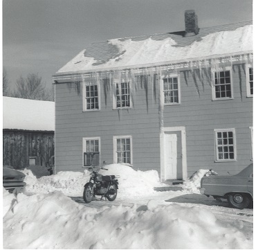 The building and adjacent barn owned by Huberman and Wallack continued to be inhabited as a rental property until it burned in early 1993. Priscilla Putnam Martin lived in the house from 1967-1971, followed by several other relatives of hers. A winter picture of this home, with the barn in the background, is dated Dec. 25, 1967 and comes courtesy of Priscilla. Over the next couple decades, the knotweed continued to spread aggressively around the property, and eventually some have said that the plant was coming up through the floorboards and plumbing pipes into the house. By January 1, 1993, the house was occupied by Sharon Paige, her husband Dana Robertson, and daughters Misty and Bobbi-Jo Paige. On January 31, 1993 an undetected chimney fire got out of control and severely damaged the home, rendering it uninhabitable. Huberman and Wallack eventually had the building taken down. The schoolhouse that once stood near the home and next to Signature Rock was purchased by another Francestown resident and removed from the property.
There was a significant push within Francestown toward land conservation and open space preservation that began in the 1990s, and by the mid 2000s, significant land within town had been conserved. It was during this window that the town of Francestown acquired the Charles Foster lot by tax deed in 2000 (Book 6254, Page 1694), designating the property as a town forest in 2007, and later, in 2018, identifying it as suitable for mountain biking trail development. The Conservation Commission also officially named the parcel the Fisher Hill Town Forest and did a fresh survey of the property, finding it to be about 40 acres in size. The problem with this parcel from a conservation and recreational perspective was that it was isolated; it was not adjacent to any other conserved lands. Conservation-minded individuals in Francestown had long considered it a stretch goal to eventually conserve all of the original Foster parcels, as these lands were located strategically at the center of three other large blocks of conserved land: the Crotched Mountain Town Forest, the Shattuck Pond Town Forest, and the Dinsmore Brook Conservation Area.
 As far as the property now owned by Huberman and Wallack, the parcels originally identified as "one" and "three" on the Foster's deed, this parcel abutted the Fisher Hill Town Forest, being located directly across Route 47. This property had remained dormant for many years, aside from a timber harvest, and it seems at one point there was talk of building A-Frames along the old turnpike to take advantage of the nearby ski area. But the ski area closed and the original house was never rebuilt. A majority of the property was put under current use designation in 1985. The knotweed continued to spread, and was made worse by the logging equipment which spread the invasive plant all around the property. Small and large patches of this terrible plant are still being found out in the woods to this day. From approximately 2008-2013, a local bike race called the Hampshire 100 passed through this property (and two of the Foster lots as well) following old snowmobile trails.
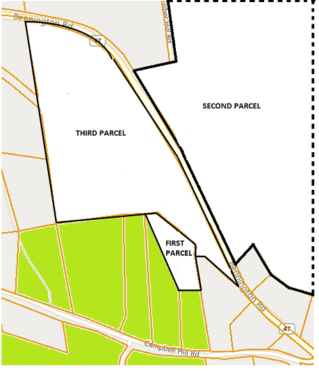
 Eventually in 2018, the property was put up for sale and sat on the market for a long time. In December 2019, Jim and Cindy St. Jean purchased the Huberman and Wallack property (now Upper Turnpike Trails) for conservation and recreational purposes (Book 9248, Page 584), donating a conservation easement to the Francestown Land Trust. They intended to expand the concept of a biking network to cover both this property and the Fisher Hill Town Forest. With this purchase by the St. Jeans, two of the four Foster lots had now been conserved (see picture). Just days before this real estate transaction closed, Huberman and Wallack executed a quit-claim deed with one of the property abutters who had competing claims for the small parcel of land described as "parcel one" containing the site of the old spring. As a result of this action, any ownership rights Huberman and Wallack had to the section of property containing that spring were given up (Book 9246, Page 1753).
 There was another original Foster property for sale around this same time, the so-called Albert Foster lot which had long frontage on Fisher Hill Road and small frontage along Route 47. This property also had frontage on Collins Brook and was an integral part of the original snowmobile trail used by the Hampshire 100 race. This property directly connected to the wooden snowmobile bridge (Fisher Bridge) used to cross Collins Brook from Old County Road North. This property was adjacent to (across the street from) the new St. Jean lot - Upper Turnpike Trails. It did not connect to the town forest directly, however, this lot was another piece of the conservation puzzle. In 2020, the Francestown Land Trust purchased this lot from Barbara (Foster) Airis (Book 9303, Page 2451) for conservation purposes but also with the express intent of re-opening the old trail used by the Hampshire 100 bike race. The trail had been destroyed by logging in the years after the bike race used it. With this action, now three of the four Foster lots had been secured and preserved for conservation and recreational purposes (see picture).
 The final piece of the puzzle was the Violet Foster McCarthy lot, sandwiched in the center of the other three lots. This lot was not for sale and honestly the funds were running low among those involved following the previous land acquisitions. However, suddenly in 2021, a For Sale sign went up in front of the Violet McCarthy lot. This parcel had been acquired by James F. and Virginia M. Comley from the heirs of Violet Foster McCarthy in 2005 (Book 7445, Page 1274) and a proposed subdivision plan was prepared for this parcel in 2006, which fortunately did not move forward. Now the property was owned by their son (Book 9344, Page 2538) and he decided it was time to sell. The old mobile home was still on the property in a very deteriorated state. There were discussions about buying the property, but the price was very high and in addition, something had to be done about the mobile home which was a liability (see photo).
 Finally, after a series of price drops, a deal was worked out. Jim and Cindy St. Jean would initially purchase the property but would pursue grants and funding through the Francestown Land Trust such that FLT could purchase the permanent conservation easement covering the property (Book 9558, Page 1227). The parcel would be incorporated into the adjacent conservation lands, and would become an integral part of the trail network. The transaction closed in late 2021 and the old mobile home was promptly removed, being replaced with a storage unit to support recreational and trail development needs. Now, all the original Foster properties, going all the way back to Thomas Fisher, had been secured for conservation and recreational purposes. The process to secure grants and funding for the conservation easement is still underway. To contribute to the effort, please contact the Francestown Land Trust.
While all this was playing out, beginning in 2020, development of the trail network started, initially focusing on Upper Turnpike Trails and the Fisher Hill Town Forest. The first trail built was My Corona, constructed during early days of the COVID pandemic in March 2020. Many volunteers, primarily from Bike 603, contributed to the effort. Trail development spread to the town forest that fall, with the opening of the Putnam Loop Trail and then the Perimeter Trail, and additional volunteers from the surrounding community joined in. Once the Violet McCarthy parcel was acquired, becoming Lower Turnpike Trails, trail development expanded to that property and significant mileage was added in 2022-2023. Finally in 2023, the old recreational trail was re-opened crossing the FLT parcel and connecting the network to Old County Road South across Fisher Bridge. The network finally hit a critical mass of 10 trail miles, and Turnpike Trails was launched in the spring of 2023.
Sources
Francestown records, town reports and archives; Hillborough County Registry of Deeds; History of Francestown, NH by Rev. W. R. Cochrane 1895; Francestown "Road Survey" and "Road Study" records (compilation of town road actions and map), 1963-1978; Frances'Town, A History of Francestown, NH by John Schott, 1972; Historical town records as documented by Thulander (date?); Various historical maps; Fisher Family Geneology by Philip A. Fisher, 1898; Laws of New Hampshire (Vol 6, 1792-1801); Journal of the Senate of NH 1837; Road Law Guide by Paul J. Alfano, ESQ, 2020; Find-A-Grave Index; FamilySearch.org; NH Superior Court case records via Caselaw Access Project of Harvard Law School; Francestown, Fifty Years of Growth and Change by Kevin Pobst, 2023; personal interviews and field research. Thanks go to the Francestown Improvement and Historical Society for access to some records and to Francestown Historian Priscilla Putnam Martin for information and photos.